
Sunday, 18 September 2016
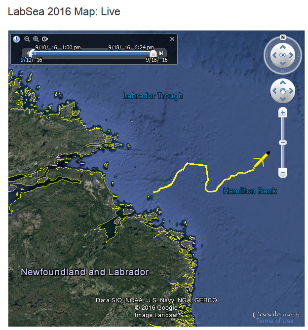
LabSea 2016: Google Earth Map
Labrador Sea 2016: Rough weather
The glider has been encountering some rough weather since it was deployed, including 45 knot winds and 8m seas. We encountered similar conditions on our way back from deploying it off Labrador.

We measured 50 km/h winds at Old Ferolle harbour in Newfoundland. Note the whitecaps on the waves.


Photo credits: Mark Downey
Return to Labrador: Part 2
With some nasty weather fast approaching, we decided to do the glider testing and deployment all in one day. We thank the crew of the fishing vessel Northern Star for all their help.

Before heading out for the deployment, we did a test dive in the harbour from a small boat.

While the others were out with the glider on the boat (seen in the far distance), Robin did the glider piloting from the comfort of the van. Note the antenna cable coming out the window.

Testing done, our gear was loaded onto the 63-foot fishing vessel we'd chartered for the deployment. We then made the four hour steam out to the deployment site.

Gannet Islands - our deployment location.

The islands are an ecological reserve and home to puffins, razorbills and murres.

Mark preps the glider for deployment. The Ganett islands can be seen in the background.

Working with the roll of the boat, we slid the glider in over the side. Once in the water, the captain (left with his hands on the controls) quickly maneuvered the boat out of the way.

Deployment over, we made the long steam back to Cartwright, arriving back by dusk.
Return to Labrador: Part 1
To get our Labrador Sea 2016 glider mission underway, it was back up to Labrador - this time to the town of Cartwright, a few hours further north along the Trans-Labrador highway from where we had deployed last year.


A dose of Newfoundland's famous fog. This narrow strip of land separating the Avalon peninsula from the rest of Newfoundland is often foggy. Incidentally, a plan is afoot to harvest Newfoundland fog and bottle and sell it as drinking water.


Departing St. John's on September 7th, we started the 1400km, three-day drive to Cartwright.


A dose of Newfoundland's famous fog. This narrow strip of land separating the Avalon peninsula from the rest of Newfoundland is often foggy. Incidentally, a plan is afoot to harvest Newfoundland fog and bottle and sell it as drinking water.

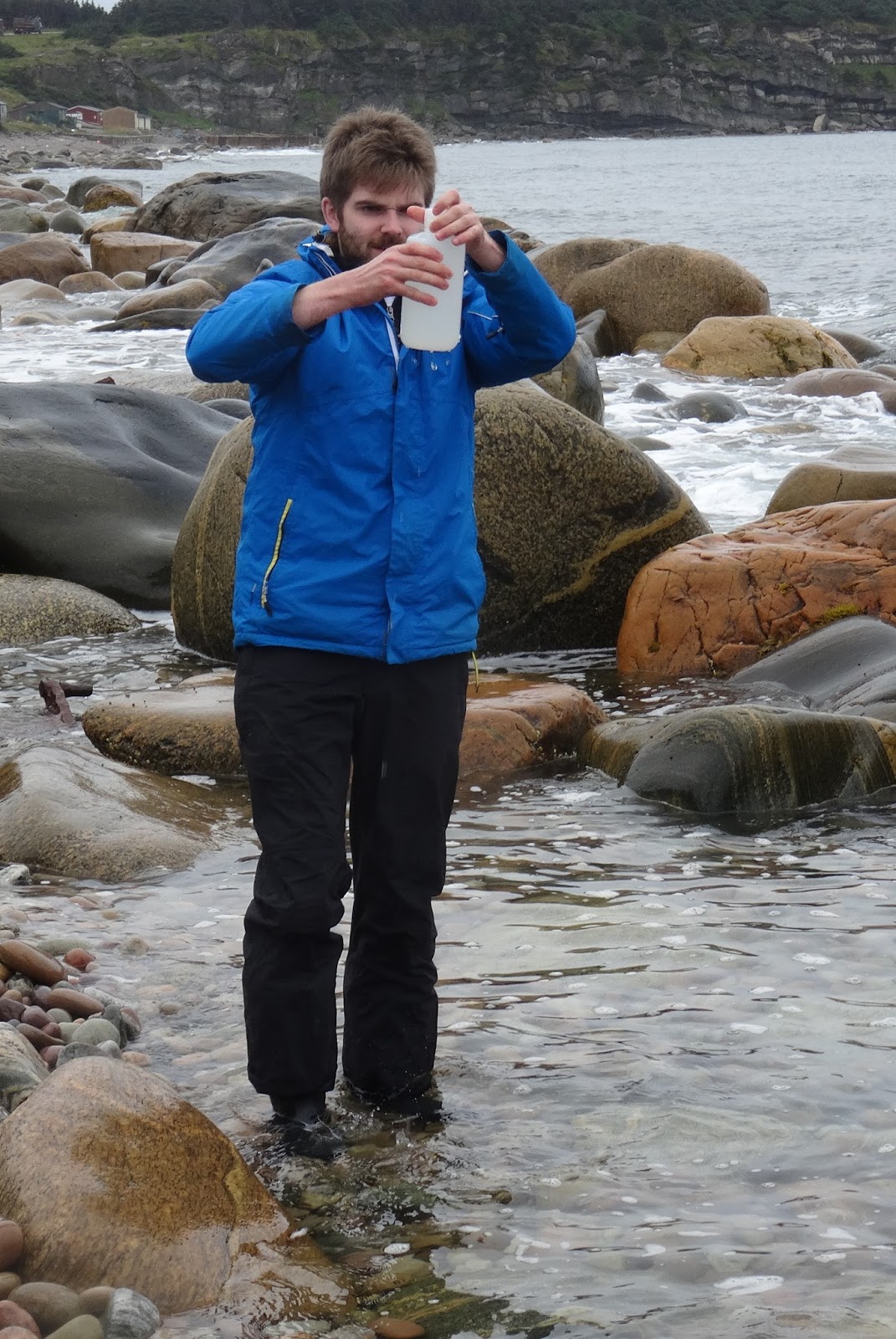
The mission glider is fitted with oxygen and carbon dioxide sensors that needed to be kept wet en-route. Here we're collecting some fresh seawater for the job at the wreck site of the SS Ethie.

Waiting to board the MV Apollo ferry across the Belle Isle strait.

Once in Labrador, it was onto the gravel Trans-Labrador highway road up to Cartwright.

The cloud of dust trailing behind vehicles on the dirt road can make it had to spot things - e.g. moose!

There only being one main road in these parts, it's hard to get lost.

Inukshuk in the town of Port Hope Simpson (where we stayed last year).

Someone's ready for winter!

Southeastern Labrador is on Newfoundland time, but further north (including Cartwright) they're on Atlantic time, half an hour different.

We made it!

Unfortunately, just as we pulled in to Cartwright, we had a flat. We enlisted none other than the town's mayor to plug it for us. After that, we made it was an early night so as to be well rested for a crack-of-dawn start the following morning...
Labrador Sea 2016 Testing: Part 2
To calibrate the glider's carbon dioxide and oxygen sensors, a make-shift chemistry lab was set up on the back deck of our fishing vessel. Water samples were taken for these parameters, together with nutrients, and we also profiled with a CTD (an instrument that measures temperature and salinity).

Our fishing boat chem lab. Water samples needing to be kept chilled were stored in our portable mini-fridge (middle left).

Seawater was collected using a Niskin bottle (top center) on a metal cable. A CTD (bottom center) was attached beneath the bottle at the bottom of the cable. A winch was then used to lower the bottle/CTD to the desired sampling depth.


The ends of the sampling bottle are initially cocked open. Once the bottle has been lowered to the desired depth, a metal weight ('messenger') is sent down the cable, triggering the ends of the Niskin to snap shut, thus capturing seawater at the bottle's depth.

The bottle is then winched back up to the surface and water samples extracted from it using a hose - in this case for nutrients.

Here, a sample for carbon dioxide has just being collected.

Chemicals need to be added to the samples for oygen and carbon dioxide - something requiring a steady hand on a moving boat.
Photo credits: Doug Piercey Jr
Labrador Sea 2016 Testing: Part 1
In preparation for our LabSea2016 mission, the mission glider was put through its paces in Trinity Bay, Newfoundland back in mid-August. We thank the crew of Belle of the Bay for their assistance.


Transporting the glider from Heart's Content out to the deployment location in the deep, middle part of the bay. The glider is special in having an extra battery bay, as well as carbon dioxide and oxygen sensors.

We couldn't have asked for better weather.

With the weather being good, we deployed the glider from a skiff.

In she goes.

Momentum carried the glider beneath the surface initially, but she soon came back up.
Wednesday, 14 September 2016
Appearance on PBS tonight
If you're in the US, Memorial University's Autonomous Oceans System Lab will be appearing in a segment on icebergs in the first episode of 'Forces of Nature' on PBS at 8pm tonight. Filming took place back in June 2015 in Conception Bay, Newfoundland.
Here's the YouTube promo. You can also check our earlier post about what went on behind the scenes.
Here's the YouTube promo. You can also check our earlier post about what went on behind the scenes.
Subscribe to:
Posts (Atom)